

Quick answer
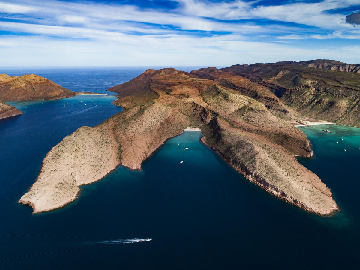
Espiritu Santo is a UNESCO-designated biosphere reserve and protected marine park located in the Gulf of California, 24 kilometers from La Paz, Baja California Sur. The uninhabited island encompasses 48,655 acres of desert terrain and surrounding waters managed by Mexico's National Commission of Protected Natural Areas (CONANP), requiring a 225 MXN per-person conservation fee for all visitors.
The island's rock formations date back 25 million years to volcanic activity that shaped the entire Gulf of California basin. Espiritu Santo remained largely inaccessible until the mid-20th century, when fishing communities established temporary camps along its protected coves. By the 1970s, scientists documenting the Gulf's biodiversity recognized the island's ecological significance—it hosts 11 endemic reptile species, including the black jackrabbit found only on this archipelago. What is Espiritu Santo today reflects decades of conservation effort. CONANP assumed management in 2000, establishing strict visitor protocols to protect nesting sites for blue-footed boobies and frigate birds. The surrounding waters support over 800 fish species and five marine mammal populations, including the resident California sea lion colony at Los Islotes, a rookery accessible only by permitted boat. The island's arid interior receives fewer than 200 millimeters of annual rainfall, creating a landscape of cardón cacti and elephant trees adapted to extreme drought. Visitors arrive exclusively by authorized watercraft from La Paz marinas, a journey lasting 90 minutes to two hours depending on sea conditions and destination cove. No permanent structures exist on the island—no docks, facilities, or freshwater sources. The archipelago includes Isla Partida to the north, connected to Espiritu Santo by a shallow channel negotiable only at high tide. Both islands fall within the protected perimeter, subject to the same access regulations and seasonal closures during breeding periods. The biosphere reserve designation requires all tour operators to carry federal permits, limit daily visitor numbers, and enforce no-contact zones around wildlife. This framework preserves what Jacques Cousteau termed the "aquarium of the world" while allowing controlled access to one of North America's most biodiverse marine environments. The island remains as it has for millennia—a laboratory of evolution isolated by deep water and protected by distance from the mainland.
“The island hosts 11 endemic reptile species, including the black jackrabbit found only on this archipelago.”
What Is Espiritu Santo Island: Geography and Protection
Espiritu Santo Island is a protected archipelago located in the Gulf of California. It holds significant ecological value due to its status as a UNESCO Biosphere Reserve, supporting distinct endemic species and complex marine ecosystems.
The archipelago encompasses 23,800 hectares of land and marine territory, designated as a National Park to preserve its volcanic landscapes and coastal biodiversity.
UNESCO World Heritage status
The island is part of the Islands and Protected Areas of the Gulf of California, a UNESCO World Heritage site recognized for its high concentration of marine life and geological significance.
32 endemic species
The island ecosystem supports 32 species of plants and animals found nowhere else on Earth, including the black jackrabbit and the Espiritu Santo antelope squirrel.
500-meter peak elevation
The island's topography is defined by its volcanic origin, reaching a maximum elevation of approximately 500 meters above sea level across its rugged terrain.
1995 establishment as protected zone
Following decades of conservation efforts, the area was formally protected in 1995 to manage human impact and safeguard the vulnerable nesting grounds of local wildlife.
2,000 year old human traces
What Is Espiritu Santo Island Best Time to Visit?
The best arrival window for Espiritu Santo Island is 08:00–11:00, as early morning departures provide calmer sea conditions and superior snorkeling visibility. Planning your visit around these hours ensures a more stable boat transit and peak underwater clarity.
Weekday mornings
Minimal—
Reduced boat traffic allows for quieter time at the beaches and snorkeling sites.
May to June
ModerateWarm, 24°C–30°C
Water visibility is highest during these months, ideal for observing marine life.
October to November
ModerateMild, 22°C–28°C
Sea temperatures remain comfortable following the summer, with stable wind conditions often present.
Verdict: The optimal time to visit is a weekday morning during May or October for the combination of calm seas, high water visibility, and lower visitor density.
What Is Espiritu Santo Island Daily Access Schedule?
Espiritu Santo Island remains open to visitors daily throughout the week, including weekends.
| Monday | 00:00–23:59 | |
|---|---|---|
| Tuesday | 00:00–23:59 | |
| Wednesday | 00:00–23:59 | |
| Thursday | 00:00–23:59 | |
| Friday | 00:00–23:59 | |
| Saturday | 00:00–23:59 | |
| Sunday | 00:00–23:59 |
What Is Espiritu Santo Island Logistics for Arrival?
Espiritu Santo Island is located in the Gulf of California, approximately 30 kilometers north of La Paz. Access to the protected area of the Archipiélago de Espíritu Santo is restricted to authorized boat tours departing from the La Paz marina area.
Authorized tour from La Paz Marina
Drive to La Paz boat departure docks
What Is Espiritu Santo Island and Its Primary Sights?
Espiritu Santo Island, a protected UNESCO biosphere reserve, features dramatic volcanic landscapes and diverse marine ecosystems. These landmarks offer opportunities to observe local wildlife and geological formations within the archipelago.
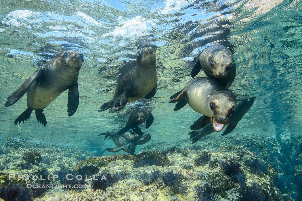
Los Islotes
A rocky islet formation serving as a protected sea lion colony, where visitors can observe the animals in their natural habitat.
Swim in designated areas to watch sea lions from a distance.
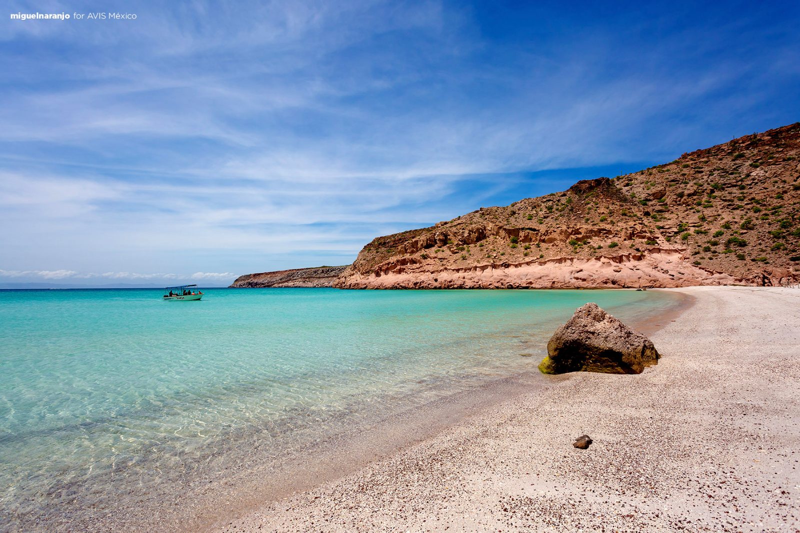
Ensenada Grande
A secluded bay characterized by white sand beaches and turquoise waters, frequently used for swimming and resting.
Visit during mid-day to appreciate the contrast of colors.

Bahia San Gabriel
A shallow bay known for its calm conditions and remnants of ancient pearl fishing camps.
Walk the shoreline to look for historic cultural artifacts.
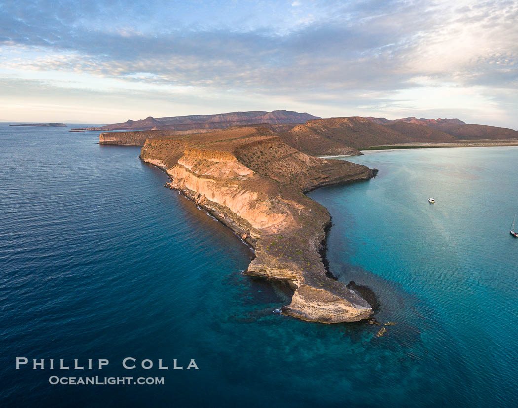
Punta Norte
The northernmost point of the island, offering panoramic views of the Sea of Cortez and rugged cliff faces.
Bring binoculars to identify sea birds nesting in the cliffs.
Check availability
Frequently asked questions about what is espiritu santo
Everything you need to know about what is espiritu santo